Submit a Trail
Horse Trails
Horse Trails
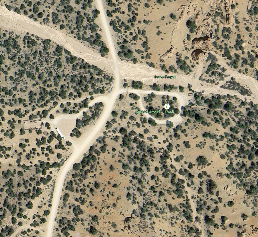
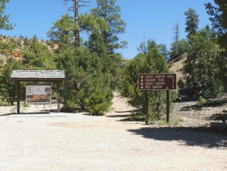
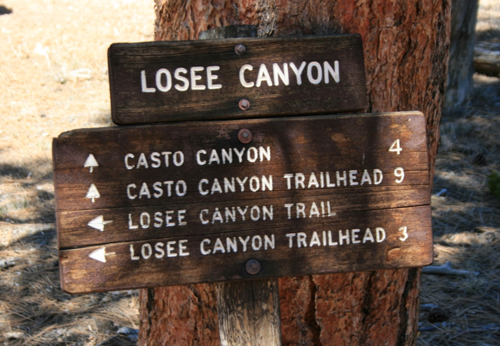
Losee Canyon Trailhead - idahotrails added this area
Panguitch, UT
Riders have logged 13.70 miles & 0.00 hours here.
TOP TRAIL RIDER: idahotrails logged 13.70 miles.
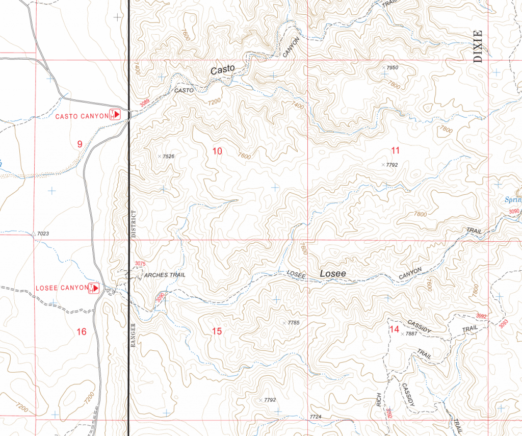
 Printable Map
-
 Directions
×
Directions
×Driving Directions
Click the icon for directions in google.Drive approximately 2 miles east on SR 12 from US 89. There will be a sign for Losee/Casto. Turn north or left onto this graded road and drive 2 miles to the Losee Canyon Trailhead. Parking is available at the Trailhead.
-

- ☆☆☆☆☆
- Printable Map
-
Directions
×
Driving Directions
Click the icon for directions in google.Drive approximately 2 miles east on SR 12 from US 89. There will be a sign for Losee/Casto. Turn north or left onto this graded road and drive 2 miles to the Losee Canyon Trailhead. Parking is available at the Trailhead.
- ☆☆☆☆☆


Rides Add Your Ride
| Date | Rider | Hours | Minutes | Miles | GPS | Photos | Rating | |
|---|---|---|---|---|---|---|---|---|
| 23 Feb 2017 | idahotrails | Ride Notes | 0 h | 0m | 13.7 | ✔ | ☆☆☆☆☆ |
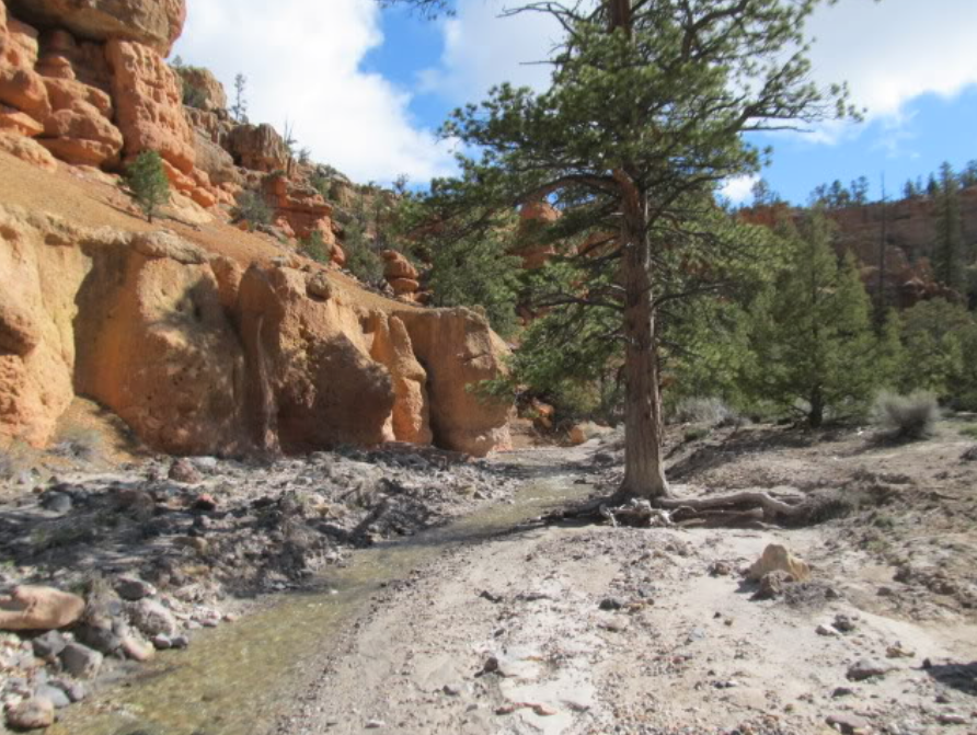
The Losee Canyn trail offers horse riders stunning red rock formations as you ride through the bottom of a wash.
- Land manager is Dixie National Forest – http://www.fs.usda.gov/recarea/dixie/recreation/hiking/recarea/?recid=40218&actid=50