Horse Trails
Horse Trails
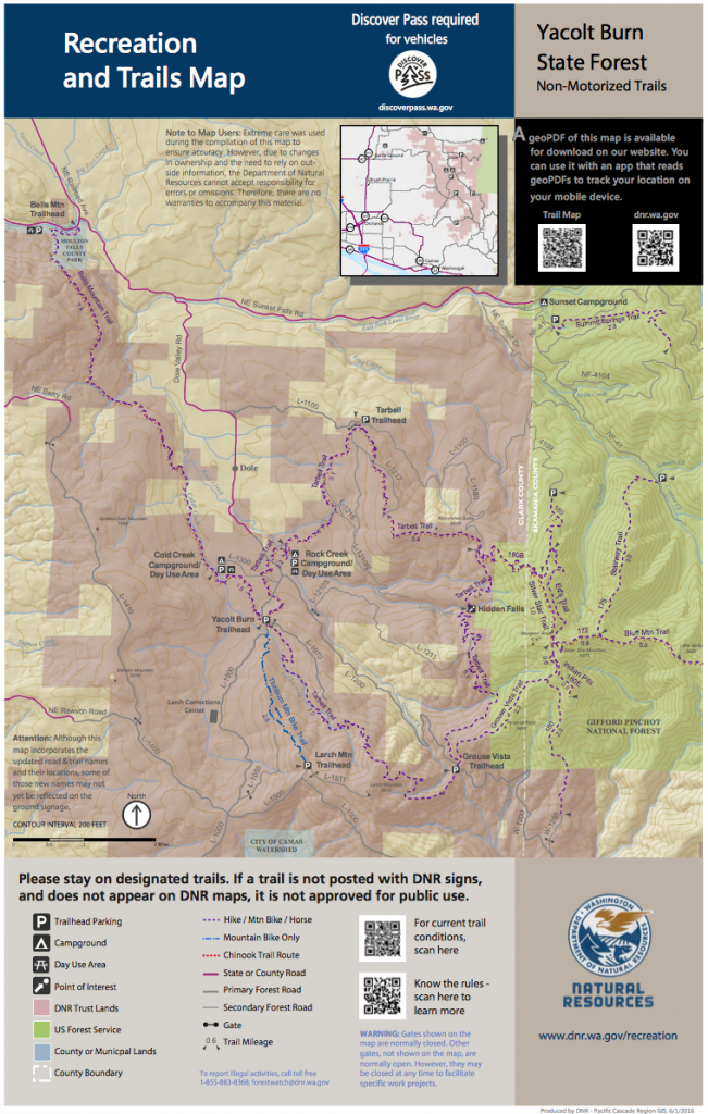
Tarbell Trailhead Yacolt Burn State Forest - 1trailmeister added this area
Yacolt, WA
 Printable Map
-
 Directions
×
Directions
×Driving Directions
Click the icon for directions in google.At entrance to Rock Creek from L-1000 continue north onto Dole Valley Road. Turn left onto the L-1100 road, and at junction with the L-1210 road, turn right and the trailhead is on your left.
-

- ☆☆☆☆☆
- Printable Map
-
Directions
×
Driving Directions
Click the icon for directions in google.At entrance to Rock Creek from L-1000 continue north onto Dole Valley Road. Turn left onto the L-1100 road, and at junction with the L-1210 road, turn right and the trailhead is on your left.
- ☆☆☆☆☆


No routes found... Be the first to submit one.
No Rides Found Be the first to Add Your Ride
Parts of the Tarbell Trail system have been in existence for more than 100 years. Tarbell Trailhead includes 35-miles of horse trails.
Horse camping opportunities are available at the nearby Rock Creek Campground. Rock Creek Campground, Yacolt Burn State Forest
Land manager is Washington Department of Natural Resources – http://www.dnr.wa.gov/Yacolt
Discover Pass is required