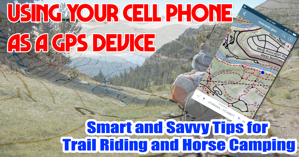
Using Your Cell Phone as a GPS
As published in the October 2019 issue of Western Mule Magazine
There’s one item that nearly everyone has on them most of the time. That same device in your pocket also happens to be an excellent navigation tool. Modern smart phones, like yours, can easily function as reliable back country GPS devices. Even when you’re outside of cell phone reception your phone is continually acquiring satellite signals. With the right app trail riders can use this feature to turn their phone into an affordable navigation tool.
If you wander afield it’s vitally important to know basic navigation skills and how to use a map and compass. That being said we live in a world of high tech gadgets and knowing how to get the most use out of them makes this information important to pass on.
Why Do You Need a GPS Device?
 When you’re trail riding, especially in the back country, reliably knowing your location is very important. Without that vital information you can quickly become lost and in for an “eventful” ride. A GPS device (and your map and compass) will allow to you to quickly and easily locate yourself and make for much safer and enjoyable trail rides.
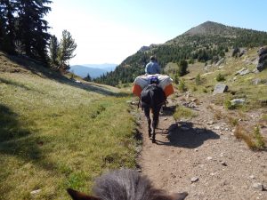
I get “misplaced” all the time. Have I missed the next trail intersection? Did I accidently go down an elk trail instead of the one I wanted? Do the trails lack clear signage? If I can’t follow my intended trail because of an obstacle, like; bear feeding on huckleberries, huge tree downfall & I left my 5’ cross cut saw in the trailer, trail washed out from a landslide, how do I bypass and continue my ride? Those feelings of “this isn’t quite right” happen to us all. But with a reliable GPS app on our phone you can have instant answers to those questions. For me learning how to turn my phone into a GPS unit makes rides nearly stress free.
Why the Phone?
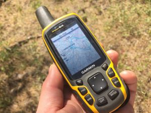 There’s a bunch of very good and reliable handheld GPS devices on the market. We’ve all seen them. I like and use them often myself. But sometimes the dedicated GPS is just another piece of equipment to carry, and I may not want to bother with the extra weight, bulk, and hassle.
 Your cell phone on the other hand is already with you and you’re probably bringing it along on the ride anyway. Modern cell phones are true multi-taskers; from taking pictures to navigation, to notes, and so much more. Learning how to use what you’re already carrying as a wilderness GPS tool only increases the value of what is already extremely handy.
How GPS Works on Your Phone
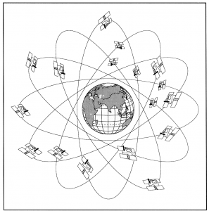 There is a network of 24 satellites that form the Global Positioning System (GPS). Virtually all modern cell phones are GPS-enabled, which means that they are constantly receiving information from these satellites and capable of pinpointing your location. It’s pretty darn handy for knowing where you are on the trail!
You’re probably wondering if you need cell service for your phone to act as a GPS. The answer is NO, you do not. GPS technology works offline anywhere in the world without mobile and data signals. Simply save maps and route guides to your device before you leave home. Even if you have no cell service your phone’s GPS is capable of operating reliably. That’s a good thing because most horse trails don’t have reliable cell service.
Which Apps?
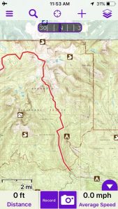
When it comes to GPS navigation apps There are two that I like and recommend above the rest: Gaia GPS (https://www.gaiagps.com/) and View Ranger (https://www.viewranger.com/en-us). Both of them work in about the same way and allow you to create customized maps by adding your own overlays, trails, GPX tracks, and waypoints for increased guidance.
NOTE: While both apps allow the option of recording your rides. I generally choose to not use this feature in order to prolong my battery life.
Using GPS Navigation Apps on a Trail Ride
After you’ve downloaded your GPS app of choice it’s time to download the correct maps for your riding area to your phone before you get out of service. I do this before I leave the house. If you don’t, your phone will still be able to locate you, but you’ll show up as a blue dot on a blurry map, and that’s not helpful at all.
Your Phone Battery
Many of us have heard or seen first-hand that smartphone batteries drain much faster when it’s using GPS. Here’s why. Once you activate location services and GPS chip is constantly listening for satellites, your phone can’t enter sleep mode.
Here’re my top tip to extend your phone’s battery life. Put the phone in airplane mode. Try it, you’ll be impressed.
If Something Goes Wrong
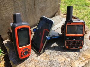 Your phone’s GPS navigation app can help you find your location, but in the event of an emergency, it can’t call for help. For this reason, and many others, I carry a satellite messenger. These devices let you send text and email messages, track your trip, and even send an SOS signal at the push of a button – all without cell service.
Here’s a list of my favorites:
- SatPaq (https://satpaq.com): A clip on antenna that turns your phone into a satellite communicator. I’ve found it to be reliable and inexpensive to own and operate.
- SPOT X (https://www.findmespot.com/spotx/lander.php): This rugged device works off satellite to send your GPS coordinates to your personal contacts or a rescue center. It features SOS for emergencies, help for non-life threatening emergencies, one-way messages for check-in, and progress tracking.
- Garmin inReach (https://explore.garmin.com/en-US/inreach/): The Explorer has a long battery life, larger screen, and built-in digital compass as well as colorful topo maps for GPS navigation. The downside is the price.
There you go Using Your Cell Phone as a GPS is easy and help get you back to camp in time for dinner!
As always for more information on horse trails and camps, trail riding and camping with livestock visit www.TrailMeister.com